Record water sports on iPhone or Apple Watch
Planning a downwinder? Mark your exit spots, check nearby channel markers, and record your track. In MarinePath 1.9 you can also follow a saved GPX track as you ride.

How can I record a water-sport session without an Apple Watch?
Record directly on iPhone with MarinePath. Choose your sport and start recording to see your GPS track, elapsed time, distance, and current speed on the map. The GPS status indicator helps you check location reception during your session. Direct iPhone recording does not require Health permission.
iPhone and Watch record separate sessions; recordings do not automatically hand off or merge.
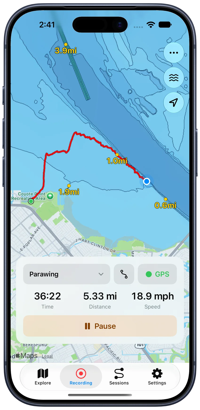
How can I follow a previous session or imported GPX route?
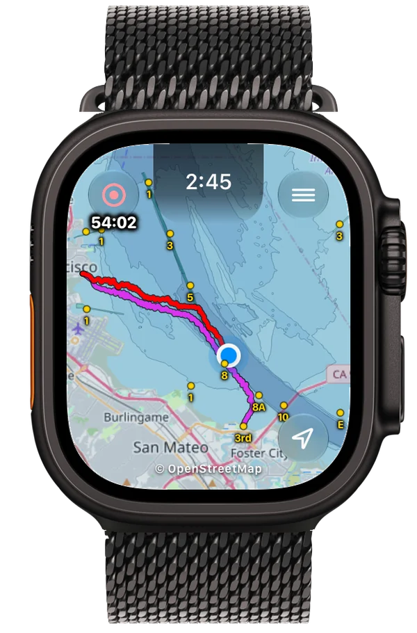
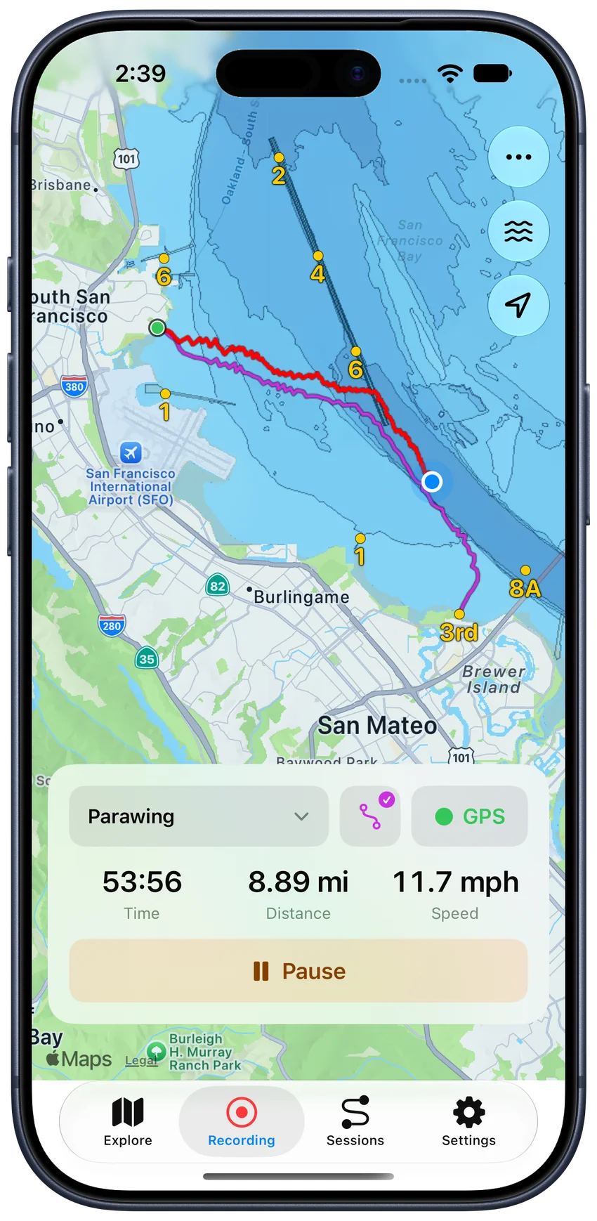
In MarinePath 1.9, use a saved session or imported GPX track as a visual guide while recording a new outing on iPhone or Apple Watch. Open a saved session and choose Save as Route. Select it from Route before or during recording. Manage your Routes library on iPhone and sync it to your Watch.
Get MarinePath on the App Store
Your new recording stays separate from the route you follow. Route following does not include turn-by-turn directions or off-route alerts.
How can I check speed and heart rate on my wrist?
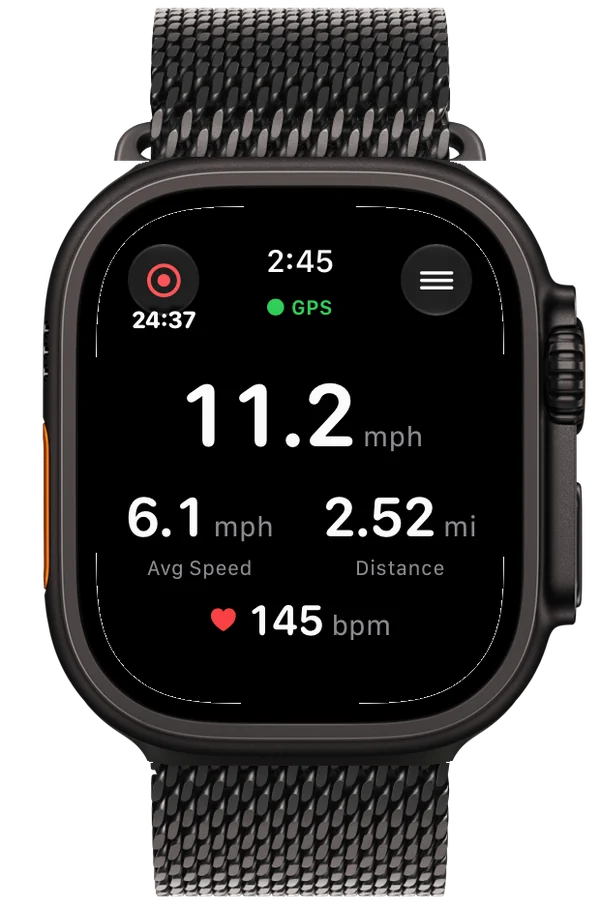
Apple Watch Live Stats shows current and average speed, elapsed time, distance, and available heart rate, together with GPS status. Choose Map or Live Stats before or during a session. On supported Apple Watches, configure the Action Button to start recording and switch views.
Watch sessions can sync to the paired iPhone for review. Heart-rate statistics depend on recorded heart-rate data.
How can I see channel markers and charted water depths?
Explore marine details on iPhone or Apple Watch with NOAA overlays where coverage is available in U.S. waters. View channel markers and optional depth soundings to understand your position relative to familiar features on the water.
Depth labels are charted soundings, not live water-depth measurements. NOAA coverage is regional, not worldwide. MarinePath supports situational awareness and recreational tracking; use official nautical charts and appropriate equipment for navigation.
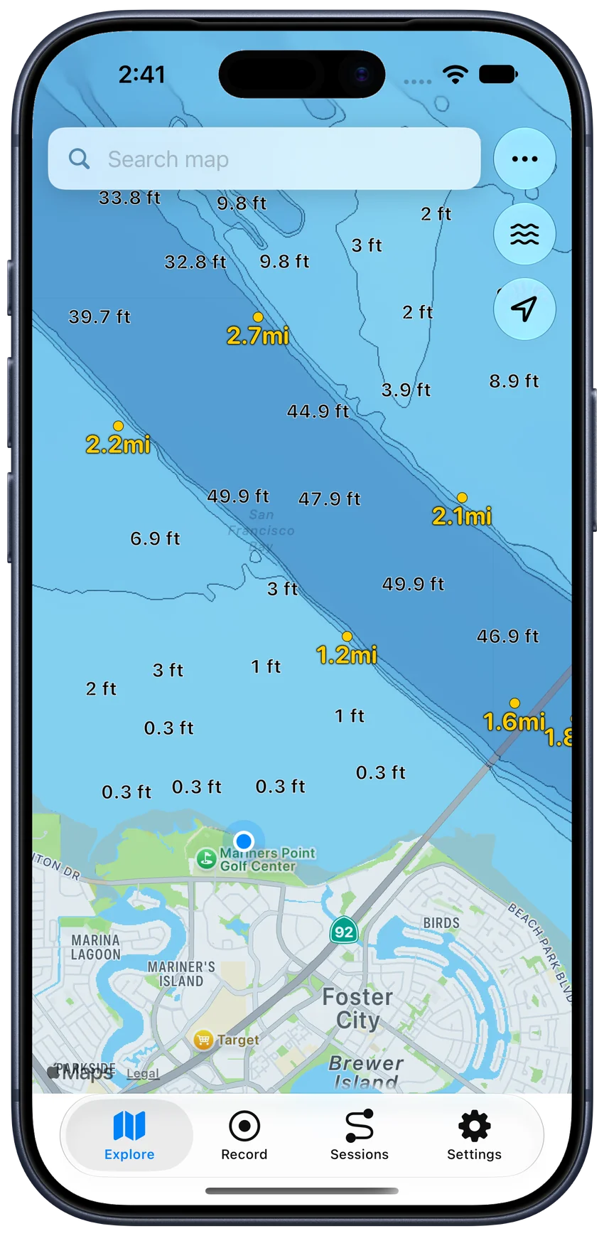
How can I keep track of exit spots on a downwinder?
Save named waypoints for exit spots and other places you want to find again. See distances to nearby markers and waypoints to help understand where you are on the water. Use the Explore map before an outing to review the area.
Downloading new map data and searching for locations require an internet connection. Previously loaded tiles may be cached, but complete offline map coverage is not guaranteed.
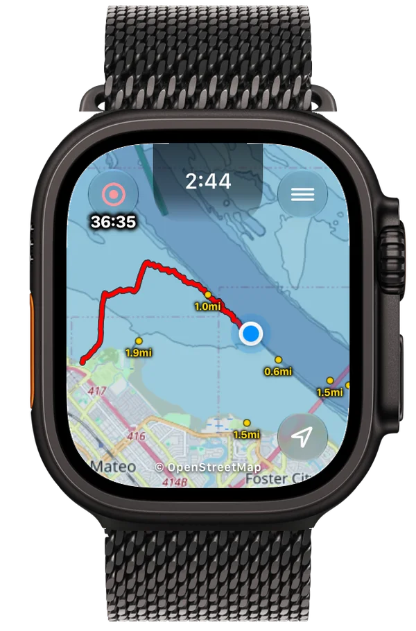
How can I review my track and heart-rate statistics?
Open a saved session on iPhone to review its track, duration, distance, average speed, and maximum speed. Explore it in Satellite view or use an optional speed-colored track. Review average and maximum heart rate when recorded and Heart Rate Stats is enabled.
Rename sessions or update their sport to organize your history. The displayed map style can be different from the one you use while recording.
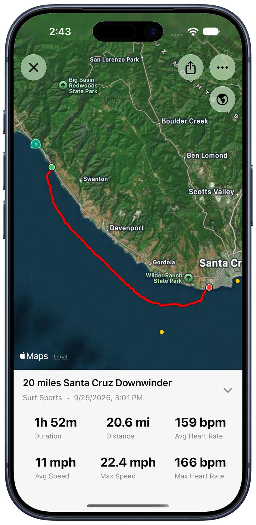
How can I share a session or export it to another app?
Create a portrait session image with the full track, session name, sport, date, and statistics. Save it to Photos or send it through the iPhone share sheet. Shared images use your session map settings and can include recorded heart-rate statistics when enabled.
Export saved sessions as GPX for compatible tools. You can also import recorded GPX tracks with timestamps from Files on iPhone. Export important sessions before deleting the app; Watch sync is not a backup.
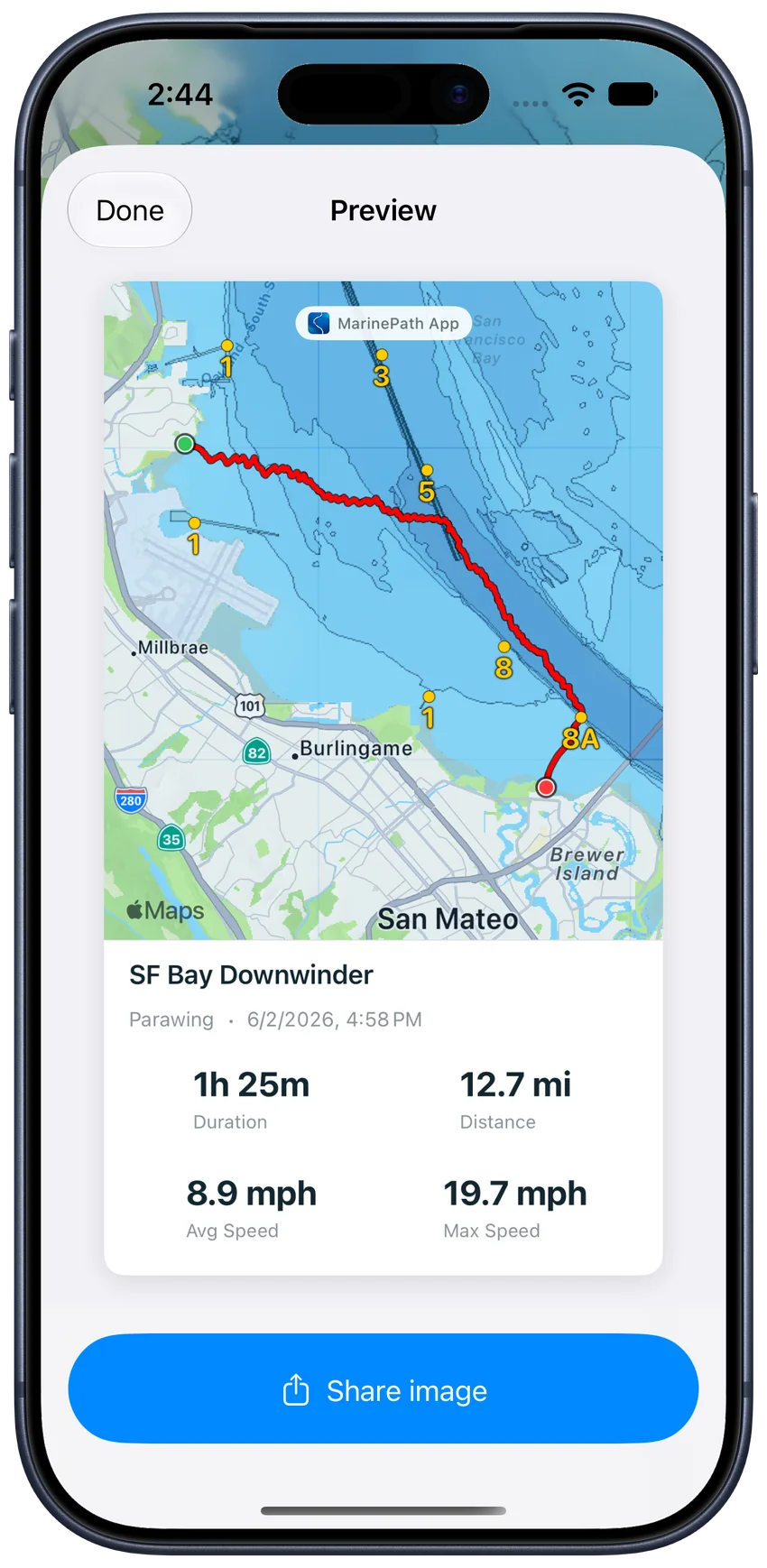
Can I record a session without internet or an account?
Direct iPhone GPS recording works without an internet connection and neither app requires an account. New map downloads and location searches need connectivity. Cached map content may be available, but it does not guarantee complete offline coverage.
The free MarinePath Web Map and GPX Viewer is a separate browser tool for exploring marine maps and viewing tracks. The iPhone and Watch apps record your on-water sessions.
Learn more
- Record a downwind foiling session
- Understand NOAA marine chart coverage
- Export a GPX track
- Setup and troubleshooting